The Story
Detailed map for runners and walkers of the south eastern fells of the Lake District National Park at the magic scale of 1:40,000.
The map has Lake Windermere in the centre. Includes Ambleside, Coniston and Kendal and the superb mountain biking area of Grizedale Forest.
- Fully detailed genuine HARVEY mapping
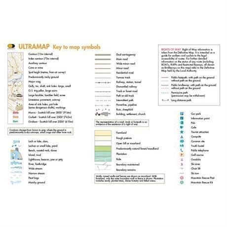
- Includes Rights of Way
- Use without a map case: tough and 100% waterproof
- Opens directly to either side of the sheet
- Scale: 1:40,000
- Ratio: 2.5cm = 1km
- Flat size: 870 x 304mm
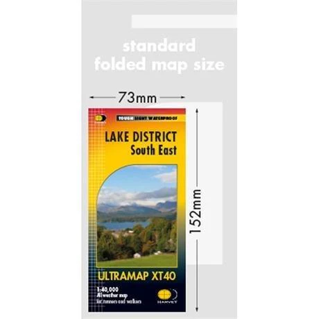
- Folded size: 73 x 152mm
- Weight: 25gms
- Area of mapping: 670sqkm
- Double sided

Details & Craftsmanship
Every detail has been carefully considered to bring you the perfect product.

Details & Craftsmanship
Every detail has been carefully considered to bring you the perfect product.
Details & Craftsmanship
Every detail has been carefully considered to bring you the perfect product.

Details & Craftsmanship
Every detail has been carefully considered to bring you the perfect product.
Description
Detailed map for runners and walkers of the south eastern fells of the Lake District National Park at the magic scale of 1:40,000.
The map has Lake Windermere in the centre. Includes Ambleside, Coniston and Kendal and the superb mountain biking area of Grizedale Forest.
- Fully detailed genuine HARVEY mapping
- Includes Rights of Way
- Use without a map case: tough and 100% waterproof
- Opens directly to either side of the sheet
- Scale: 1:40,000
- Ratio: 2.5cm = 1km
- Flat size: 870 x 304mm
- Folded size: 73 x 152mm
- Weight: 25gms
- Area of mapping: 670sqkm
- Double sided